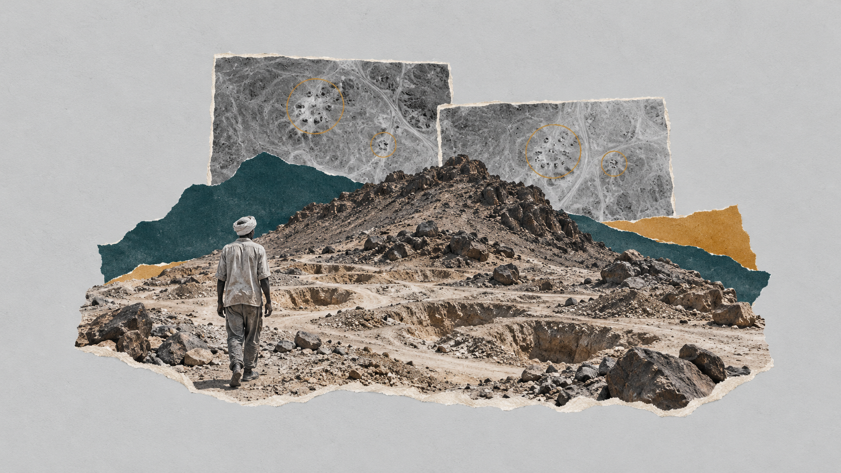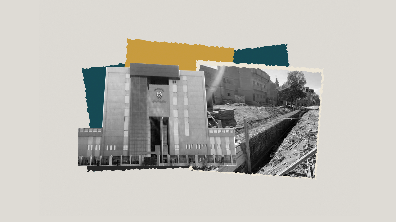
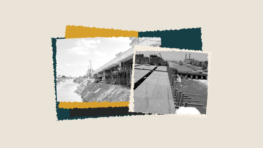
A comparison of satellite images conducted by Zawia3 between May 2020 and June 2026 shows the Tawfiqi Canal narrowing by as much as 31% at some locations, alongside the disappearance of parts of its historic tree cover and the replacement of some banks with concrete walls. Zawia3 examines whether filling in the waterway to build a new road complies with the Water Resources and Irrigation Law, as well as feasibility studies and water, environmental and urban research.
On the evening of 7 October 2021, the General Authority for Roads and Bridges issued a statement denying social media reports that the Tawfiqi Canal was being filled in to build a new road. It said it was constructing the road on the eastern bank in coordination with the Irrigation Ministry. Yet an official response published in newspapers around the same time contained a detail more consequential than the denial: in some places, building the road had indeed required incorporating part of the canal’s watercourse, according to a study by the National Water Research Institute that set what was called the “equivalent limit”. Five years later, with work continuing on the 73-kilometre expressway east of the Tawfiqi Canal between Banha and Mansoura, a question that the published figures have not settled returns: how much of the waterway has been taken?
On the same day, Extra News, owned by United Media Services, broadcast a television report on construction of the East Tawfiqi Canal road. It sought to present a reassuring picture of the project’s impact on the watercourse through interviews with several residents whose views, it said, were consistent with the Roads and Bridges Authority’s statement. Strikingly, however, their accounts did not directly answer questions about infilling and its impact on the watercourse. The first resident said there was “no infilling at all”, before explaining that infilling had indeed taken place but was subsequently removed after the piles supporting the bridge were installed. He added that the water was still flowing normally and that he had no problems on his farmland. The second resident did not address infilling, focusing instead on the new road’s width, its extension from Banha to Mansoura and Damietta, and the fuel savings and easier vehicle movement he expected. Similarly, the third resident described it as “one of the best projects carried out under Sisi”, saying it would ease traffic pressure and reduce accidents. The fourth chose to thank the president, saying that roads and bridges that had not existed before had been built during his rule.
The Tawfiqi Canal takes its name from the reign of Khedive Tewfik. It is one of the main canals branching from the Delta Barrages system and was dedicated to irrigating the eastern Delta. The authority says the new road runs alongside a waterway serving agricultural command areas in Qalyubia and Daqahlia. The Tawfiqi Canal is linked to the structures of the Mohamed Ali Barrages at Qanater Al-Khayriya, which regulate water distribution to several main canals, according to Environment Ministry data, alongside the Sharqawiya, Basousiya, Abu Al-Munagga and Ismailia canals.
Zawia3’s examination of maps and irrigation and transport data shows that, along the new road’s route, the Tawfiqi Canal serves farmland in the districts of Banha, Kafr Shukr, Mit Ghamr and Aga, ending in Mansoura. Building the road nevertheless required expropriation for public benefit. In an announcement published in Al-Waqa’i Al-Misriyya on 21 July 2026, the Egyptian Survey Authority announced the display of schedules and maps detailing private property and the compensation assessed for its owners as part of the project to build an expressway east of the Tawfiqi Canal from Banha to Mit Ghamr. The initial compensation estimate for land needed for the project was approximately EGP 817.735 million in Qalyubia and EGP 128.740 million in Daqahlia, a combined EGP 946.475 million, according to the Egyptian Survey Authority.
Zawia3 contacted three owners of expropriated land in the villages of Kafr Abu Al-Enein, Mit Nagi and Kafr Al-Sharaqwa. All three confirmed that they had received no compensation by publication. Speaking separately on condition of anonymity for their safety, they said the authorities had not yet set a price for the expropriated land. Two owned existing buildings. One lost his entire garden and half the built area of his home to the new road, while the other half of the partly demolished house was left standing. The second person’s entire home was demolished to incorporate its full footprint into the road. The third lost a strip of land running parallel to the road, between five and seven metres wide.
What the official statements do not say
Using figures and satellite images, Zawia3 traced how the East Tawfiqi Canal road took metres from the watercourse and its tree cover, revealing a reduction in the canal’s width of up to 31% in some areas. The analysis draws on Google Earth imagery from May 2020, before the project began, and June 2026, as work continued. The images show a marked contraction in the width of the canal’s water surface, accompanied by extensive clearance of historic tree cover on both banks, replaced by concrete walls and asphalt barriers to support the road expansion.
Satellite measurement tools comparing the waterway before work began in May 2020 with its current condition show clear narrowing in Kafr Shukr district and its villages. The canal’s width fell from 50.3 metres in 2020 to just 34.8 metres now, losing more than 15.5 metres, or approximately 31%. Opposite Al-Manshaa Al-Kubra village, it narrowed from 48 metres to around 36 metres, a loss of more than 12 metres. The width at the lock also fell from 52.2 to 43.1 metres, a reduction exceeding nine metres. Around Kafr Shukr Industrial School, Tasfa Stadium and the edges of residential settlements, the loss ranged from three to six metres, as concrete retaining walls replaced the canal’s natural earthen slopes.
The cost of building the road extended beyond narrowing the waterway to one of the canal’s defining features for decades: its dense tree belt. Comparing satellite images reveals the disappearance of continuous rows of eucalyptus, sycamore fig and palm trees. These held the earthen embankments together, provided natural windbreaks for neighbouring farmland, and helped lower temperatures and reduce pollution. These green belts became asphalt shoulders and Jersey barriers, with no indication that the lost green spaces on either side of the expressway would be replaced.
Lawyer Bassam Abu Jaziya says Article 1 of Water Resources and Irrigation Law No. 147 of 2021 places clear restrictions on dealings with watercourses. These include main irrigation canals, public canals, public drains and flood channels supervised by the Ministry of Water Resources and Irrigation. This brings the Tawfiqi Canal within the law’s protection once the ministry’s jurisdiction and supervision are established. He tells Zawia3 that Article 84 prohibits filling watercourses or their embankments with silt, soil or other materials. It also prohibits obstructing water flow or disrupting water balances.
Abu Jaziya raises a technical and legal question: did the project approvals cover actual infilling, or only the piles and structures needed for bridges? He tells Zawia3 that approval of the road project by the competent authorities does not exempt associated works from the rules protecting the watercourse. Article 5 gives the Ministry of Water Resources and Irrigation authority to supervise works undertaken by different bodies on public property related to water resources and irrigation. It prohibits changes, alterations or authorisation of works there without ministry approval. Article 9 likewise prohibits any private work within the boundaries of such property without a ministry licence.
Zawia3 did not rely on satellite imagery alone. It also visited the sites to document completed construction and work still under way. The photographs and videos show an engineering approach that adapts the waterway by casting concrete piles inside the Tawfiqi Canal, leaving the road seemingly floating in part over the canal’s shoulder in some areas, alongside taking portions of the channel by filling them to create road lanes.
Zawia3 contacted Assistant Minister of Water Resources and Irrigation Khaled Wasif with questions about the East Tawfiqi Canal road’s effects on the watercourse, irrigation network and farmland benefiting from it. Wasif initially welcomed the questions and asked for them to be sent on WhatsApp. After reading them, however, he said he gave statements only to journalists registered with the ministry, without answering the technical questions posed.
Former Minister of Water Resources and Irrigation Mohamed Nasr Allam stresses the adverse effects of infilling watercourses on water flow and its delivery to farmland. He tells Zawia3 that any encroachment on a watercourse, however small, “even a quarter of a metre”, affects the efficiency of water reaching users. Allam says infilling will affect water movement and farmers’ access to it, explaining that the impact is not confined to large filled areas but can also result from small sections. Any change to watercourse routes or cross-sections affects users, he adds, noting that farmers objected even to limited changes in waterways during his tenure as irrigation minister.
Allam says the ministry is primarily responsible for all canals and watercourses and for preventing encroachments, whether by individuals, contractors or government bodies. He tells Zawia3 that the duty to protect waterways does not disappear merely because infilling is connected to a government project. The ministry must exercise its oversight powers and take the necessary legal action against any encroachment, he adds. The law gives the competent authorities tools to address violations, including enforcement measures and reporting infringements to the police.
Any violation, such as the ongoing infilling of the Tawfiqi Canal, requires action by the Irrigation Ministry, Allam adds. It should not be treated as an ordinary consequence of carrying out projects, particularly when it threatens farmers’ access to water. He calls on the press to document, publish and follow up on these incidents, adding: “A contractor cannot be allowed to ruin the livelihoods of thousands of farmers, only for us to say: we called the minister and nobody answered.” Protecting farmers’ rights requires parallel action by citizens, oversight bodies and the media, he says. Given the potential impact on large numbers of farmers, the issue should not be taken lightly and warrants greater media attention and serious follow-up.
Abu Jaziya explains that the law provides penalties for prohibited acts. Under Articles 84 and 103, unlawful infilling in waterways is punishable by a fine of EGP 10,000 to EGP 50,000, doubled for repeat offences. Article 105 also provides for imprisonment of up to one year and a fine of up to EGP 50,000 for obstructing water flow or disrupting water balances. Article 110 applies to contractors or those undertaking works without ministry permission or in violation of the law, he notes, underscoring the importance of examining implementation contracts, technical instructions, supervision records and any suspension or corrective orders. He tells Zawia3 that Article 84 empowers the ministry to remove violations administratively at the offender’s expense, while Article 119 regulates orders requiring the encroacher or beneficiary to restore the original condition.
Concrete is built, people bear the burden
Through canals, lateral channels and irrigation ditches, the Tawfiqi Canal serves around 171,000 feddans of farmland across six administrative areas in Daqahlia and Qalyubia, according to data analysed by Zawia3 from the Central Agency for Public Mobilization and Statistics’ Agricultural Area and Ownership bulletin, updated in 2023. Arable land in Mit Ghamr totals around 52,200 feddans, followed by Aga with 50,800 and Banha district with 36,600. Together, Mit Ghamr and Aga account for over 60% of the total area benefiting from the canal’s water. Kafr Shukr has around 13,500 feddans, compared with 17,800 in Mansoura and its district.
Zawia3 contacted four farmers with holdings beside the Tawfiqi Canal in Ezbet Hilal and Ezbet Wasif, both in Mit Ghamr. All agreed that water levels had fallen for more than three years and that fishing had become difficult because stone pitching and lining works now obstructed recreational and professional fishers. In separate interviews, they also said road construction had involved uprooting trees along the bank and demolishing and rebuilding parts of historic bridges, including Mit Nagi Bridge, which experienced a collapse some time ago because of construction of the new road.
Ibrahim Ezz El-Din believes new road routes should not be chosen solely for engineering convenience or lower direct construction costs. They require a multi-criteria assessment covering traffic efficiency, economic feasibility, environmental and social effects, land-use patterns and the area’s hydrological characteristics. He tells Zawia3 that these considerations are especially important for the East Tawfiqi Canal road because it passes through an intensively farmed part of the Delta. Land there has high productive value, and opportunities to replace lost areas with equivalent land are limited, in addition to its connections to irrigation and drainage networks and economic and social activities established over decades.
Assessing the road’s effect on farmland should go beyond calculating the area it directly occupies, Ezz El-Din says. It must consider fragmentation of holdings, farmers’ difficulty accessing their land, construction impacts on irrigation and drainage networks, and whether the remaining portions can be used economically. He tells Zawia3 that a project’s success is not measured only by kilometres completed or traffic volumes, but by its net social, economic and environmental benefits after direct and indirect costs are counted. He warns that a road may deliver regional traffic gains while concentrating economic and environmental losses in local farming communities.
East of the Tawfiqi Canal, after development to the west
Between 2015 and 2020, the state upgraded the road between Banha and Mansoura, west of the Tawfiqi Canal. This involved widening traffic lanes and building bridges and flyovers at water crossings, village and district entrances, and railway crossings. The road improvements at the time were accompanied by infilling at several points on the western side of the watercourse, as well as the demolition of several small prayer halls on the canal bank. In response to criticism, Religious Endowments Minister Mohamed Mokhtar Gomaa said: “No mosque or prayer hall was demolished except for the public interest.”
Public figures for the East Tawfiqi Canal road project began appearing in 2021. The first phase, a 30-kilometre stretch between Banha and Mit Ghamr, was announced at a cost of EGP 4.3 billion, with eight surface bridges, one engineering structure for the canal and 13 irrigation intakes. In May 2022, Youm7 reported that the Banha–Mansoura expressway would extend 73 kilometres and include 15 engineering structures. During an inspection in April 2023, the transport minister promised that the first 15-kilometre phase would open in mid-May that year. Yet the opening of the stretch from Banha to Kafr Shukr to traffic in one direction was not announced until November 2023.
On 27 February 2026, the Transport Ministry announced the completion of 18 kilometres as far as Mit Al-Ezz village and the start of work on the 15-kilometre Mit Al-Ezz–Daqadous stretch, with eight bridges, including the completed Sahrajt and Mit Al-Ezz bridges. The ministry’s review, published on 30 June 2026, instead referred to 17 kilometres of the first phase being completed, work under way on another 15 kilometres, and plans for the remaining 51 kilometres. On 25 September 2026, the irrigation minister listed the East Canal road from Banha to Mit Ghamr among expropriation projects implemented between July 2025 and June 2026.
Ezz El-Din distinguishes compensation for farmland’s market value from compensation for the economic and social losses caused by its expropriation. Land is not simply a property asset with a fixed price, he explains, but a means of production and a continuing source of income, tied to investments in soil, irrigation networks, crops, labour and local economic relationships. He tells Zawia3 that assessing compensation’s fairness should include the land’s fair market value at the time of expropriation; losses of crops, trees and agricultural structures; the reduced economic value of remaining portions because of fragmentation or access difficulties; and lost income or interrupted economic activity during and after construction.
The assessment should extend beyond landowners to agricultural workers, tenants and other users whose incomes may be affected, Ezz El-Din adds. It should consider whether compensation is sufficient to enable those affected to recover their previous living standards and economic activities. From a spatial-justice perspective, the urban researcher warns against imposing direct and permanent losses on farmland owners to build infrastructure for people passing through. This does not negate the principle of expropriation for public benefit, he says, but requires demonstrating necessity and proportionality, ensuring fair compensation, and providing effective grievance and review mechanisms. He also notes the limits of judicial oversight of expropriation decisions in Egypt, saying landowners need safeguards that allow them to challenge decisions affecting their property effectively.
Egypt, the gift of the Nile, and the infilling of the Tawfiqi Canal
The authorities’ account is that the road is being built on the eastern bank in coordination with the irrigation directorates in Qalyubia and Daqahlia to preserve what they call the “safe hydraulic cross-section”. It also includes constructing a berm for the channel to protect the canal’s side from collapse after, according to the official account, years of clearance works eroded it and threatened the road embankment. The same explanation recurred in Transport Ministry statements. Official statements also said the work did not affect the passage of sufficient water discharges to the benefiting canal reaches, in accordance with the equivalent limit set by the National Water Research Institute. However, they give no figures for that limit, the channel’s original width or its width after construction.
After professors at the National Water Research Institute declined to answer Zawia3’s questions, we contacted Water Resources and Irrigation Ministry spokesperson Mohamed Ghanem to request access to the institute’s study. It had established the so-called equivalent limit intended to ensure that infilling the Tawfiqi Canal would not affect water discharges. By publication, however, the ministry had refused Zawia3 access to the full technical study, its executive summary, calculation appendices or approved engineering cross-sections.
At the same time as road construction began, the state was proceeding with the national project to rehabilitate and line deteriorated canals, with the stated aim of conserving water. In Qalyubia, the head of the Central Administration for Water Resources and Irrigation and the deputy governor inspected bridges being built over the Tawfiqi Canal while also following lining works on the governorate’s canals. At the Egypt Forum 2026, the irrigation minister announced that approximately 8,000 kilometres of canals had been lined, against a target of 10,000.
Under the official account, two approaches exist side by side: a policy saying every drop of water counts and warrants lining, and a road project that incorporated parts of one of the eastern Delta’s most important irrigation waterways. Another contradiction appears in the same authorities’ conduct. On 1 July 2026, the Irrigation Ministry took action against a crane driver who dumped waste on the Tawfiqi Canal’s slope at kilometre 30.3 on the right bank. An official report was filed and a removal order issued.
Dr Nabil El-Hady, professor of architecture and urban design at Cairo University, notes that narrowing a watercourse’s cross-section may change its flow velocity, making it necessary to study the hydraulic effects of infilling before carrying it out. He tells Zawia3 that reducing the Tawfiqi Canal’s cross-sectional area may increase current velocity. If that exceeds the appropriate limits for the channel, it can cause scour or other engineering problems. Assessing these effects requires specialised technical calculations that account for the watercourse’s nature and hydraulic characteristics, he says.
Some road construction uses bridges supported by concrete piles inside the channel rather than filling it completely, preserving part of the hydraulic cross-section, he adds. Nevertheless, determining how those structures affect water movement remains dependent on the engineering designs and the manner of implementation. The road has been under construction for several years, he notes, and assessing completed works requires access to the studies and calculations used by the bodies responsible for design, and an examination of how they addressed potential impacts on the watercourse.
Abu Jaziya says the law distinguishes unlawful infilling from obstruction of water flow. Even if fill was demonstrably removed after construction, that alone does not answer the question of hydraulic impact. It remains necessary to establish whether the works changed the cross-section or affected its capacity to convey water discharges during or after construction. Resolving this requires comparing surveys and cross-sections before and after the project, specifying average width and hydraulic cross-sectional area, and reviewing calculations of discharge, velocity and water levels, alongside the technical study on which the Irrigation Ministry based its approval, he tells Zawia3. Without these data, it is impossible to assert that the channel was not obstructed, and residents’ testimony that water is flowing normally should not suffice.
Ezz El-Din says assessing road projects’ feasibility requires distinguishing three levels: traffic efficiency, economic returns, and social and environmental impacts. Expanding the road network or creating a new route is not sufficient proof that the intended public benefit has been achieved. He points to social cost-benefit analysis, which measures benefits and costs over the project’s operating life rather than construction costs alone. It includes tracking actual changes in journey times, vehicle operating costs and accident rates; comparing traffic volumes against available alternatives; and considering construction and maintenance costs and improved access to markets, services and employment.
Ezz El-Din tells Zawia3 that the assessment should also include indicators measuring farmland losses, annual production forgone, the cost of fragmented holdings, impacts on irrigation and drainage networks and water quality, the number of affected households and individuals, interrupted economic activities, and how compensation compares with actual losses. Geographic information systems and satellite imagery can track land-use changes before and after construction and link them to data on holdings, population and road networks, helping measure the project’s actual effects, he says. The real test is not simply whether journey times improve, but whether the project produces a positive net social benefit with a fairer distribution of gains and burdens between beneficiaries and those harmed.
“We do not rely on feasibility studies”
Speaking at the Africa 2018 Forum, Sisi said: “If we had followed feasibility studies, we would have carried out only 25% of the projects.” He argued that Egypt’s circumstances and development needs did not always align with economic theories. He cited the New Suez Canal project, which he insisted be completed in one year rather than three despite the difficulties imposed by accelerated implementation. At the opening of the first industry forum in 2022, he repeated the same view: “There are projects that do not need feasibility studies, and we have no time to lose.” He said some projects did not require detailed feasibility studies, considered their viability settled and, in his description, saw no need to waste time studying them. He cited projects to manufacture approximately 150 products and production inputs that Egypt had imported for years.
Built Environment Observatory researcher Ibrahim Ezz El-Din questions which alternatives were considered before choosing the East Tawfiqi Canal road route. Urban planning and transport engineering require comparing a proposed route with feasible alternatives, especially in areas of high agricultural and environmental sensitivity, he explains. He tells Zawia3 that the comparison should have included upgrading existing roads, reorganising intersections and building limited links to address bottlenecks, while examining alternative routes that reduce the acquisition of farmland.
He stresses the importance of studying what project appraisal calls the “no-build scenario”. This does not necessarily mean leaving everything unchanged: it may include better traffic management, maintenance of existing roads and improvements to public transport. It allows the road’s actual added value to be measured against other solutions with lower social and environmental costs. Choosing a route beside a watercourse may seem cheaper from an engineering perspective, he notes, but creates additional burdens involving embankment reinforcement, infilling impacts, reorganisation of irrigation networks, compensation for landowners and structures, and agricultural losses extending over years. He asks whether the implementing bodies compared the route with less harmful alternatives through published, documented studies, or confined themselves to engineering considerations and construction costs.
Abu Jaziya explains that legal protection of the watercourse extends to farmland’s right of access to irrigation and drainage. Article 22 regulates cases in which a plot’s irrigation or drainage route is changed or cut off because of public-benefit works. It requires an alternative irrigation or drainage route to be created before the original is cut, at the expense of the entity making the change. Article 23 addresses compensation for harm suffered by people as a result of decisions concerning such works, he tells Zawia3.
The business behind the project
Samcrete Egypt won an EGP 777.5 million contract from the General Authority for Roads and Bridges to build Kafr Al-Naeem Bridge and reinforce the canal embankment as part of the East Tawfiqi Canal expressway project, on the stretch between Mit Al-Ezz and Daqadous, according to informed sources cited by Al-Shorouk on 4 July 2026. Samcrete Egypt’s chairman is Karim Sami Saad, who also serves as chairman of the East Port Said Development Company. Samcrete Egypt is also one of the constituent entities of the National Egyptian Railway Industries Company, NERIC, established in late 2020 with participation from the Sovereign Fund of Egypt, the Suez Canal Economic Zone, Hassan Allam, Connect and Orascom Construction.
Samcrete’s project portfolio and its intertwined activities with government bodies show the extent of its involvement in Egyptian public projects. Its work includes buildings in the New Administrative Capital’s government district, road and transport projects such as the Regional Ring Road and Middle Ring Road, other road and transport infrastructure upgrades, and participation in major projects including the American University in Cairo’s new campus, Banque du Caire in the Administrative Capital, and the Latin Quarter in New Alamein. These links extend to transport through participation in a contract with Hyundai Rotem to manufacture metro trains locally. The projects reveal the company’s presence in sectors directly tied to the state’s infrastructure, urban development and transport investment plans.
More recently, on 30 October 2026, ADD Properties, chaired by Bassel Sami Saad and part of Sami Saad Holding, secured approximately USD 265 million in financing to develop a hotel overlooking the Grand Egyptian Museum and the Giza pyramids. The financing came from the European Bank for Reconstruction and Development, the International Finance Corporation, Emirates NBD Egypt and the National Bank of Egypt.
The Tawfiqi Canal case is about more than metres taken from a waterway or trees removed to make room for asphalt lanes. It is a broader test of how infrastructure projects are planned and their true costs calculated. While the authorities maintain that the work followed an “equivalent limit” ensuring continued water discharges, the study underpinning that account remains unavailable to the public. No technical answers have resolved the changes revealed by satellite images showing the canal narrowing by around 31% in some locations, while owners of expropriated land still await the determination of their compensation.